The North fork of the Stilly is probably 20 miles South of us so we're in no imminent danger. There have been other slides along this river but none, as far as I know, of the magnitude of this one. Plus the area was more sparsely settled back then.
It's really hard to grasp the scope of the thing even from the aerial photos. If you haven't seen it before:
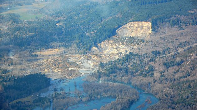
Those are 60'+ tall douglas fir trees tossed around like matchsticks. There are only two roads/hiways leading to the little town of Darrington from the West. One is State Route 530 which is totally blocked by mud and debris for a mile or so. At first it was feared that the dam that resulted from the slide would block give way and send a 10-15' wall of water down stream several miles creating a flash flood. But those concerns have lessened as the river has been diverted into an earlier channel that was, ironically, an old river bed that was blocked by one of those earlier slides.


